
Blog
Advanced GPS Systems for Civil Engineering

Sep
Civil engineering is a field where accuracy and speed are essential at every step. Road construction, building design, and survey plans all depend on accurate data. Hence the need for engineers. Advanced GPS Systems for Civil Engineering These systems provide fast results with advanced technology, saving both time and cost on projects.
If you are looking for a reliable and trustworthy GPS system then this is the best option. DJB Machine Parts Here you get high quality products designed by professional engineers.
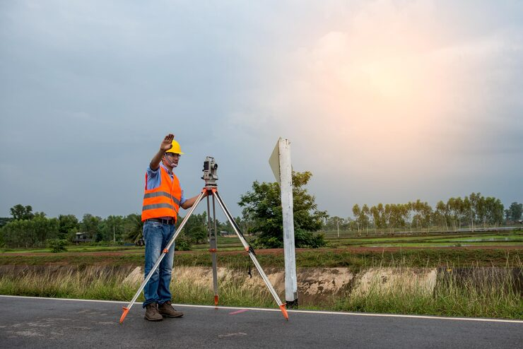
Faro Focus Premium Laser Scanner
Every civil engineer needs detailed 3D survey data. Faro Focus Premium Laser ScannerAn advanced tool that provides fast and accurate scanning. This machine captures intricate details in projects and simplifies the design process.
This scanner is used in road plans, building layouts and large area surveys. Engineers prefer it as it saves time and provides clear results. This tool is a reliable investment for every professional.
FJD AH2 Hydraulic Autosteer Kit
Straight lines and accurate steering are very important in civil engineering. FJD AH2 Hydraulic Autosteer KitThis is the best solution. This auto steering system fits heavy machinery and provides smooth control.
Its design is modern and reliable for every project. It is used in both construction and agriculture. It helps to complete large-scale projects faster and reduces human error.
FJD AS2 Steer Ready Autosteer System
For engineers who want a ready-made and easy installation system. FJD AS2 Steer Ready Autosteer System is the best option. Your modern GPS system for every civil engineering project gives me accurate performance.
This auto-steering solution offers simple setup, easy fitment with any machinery, and accurate results. Engineers who want fast and practical solutions choose this product.
Leica GS18 GNSS RTK Rower
An excellent choice for surveying and mapping projects Leica GS18 GNSS RTK RowerThis system provides fast and accurate positioning in field surveys. Civil engineers prefer it because its speed and accuracy are unmatched.
GNSS RTK Rovers are used in bridges, roads and mapping projects. They deliver professional results and are a reliable product for long-term investment.

Advantages of an Advanced GPS System
- Project speed and accuracy are critical.
- Human error is rare.
- Surveying and mapping becomes easy.
- Saves cost and time on large projects.
Civil Engineering Systems
Modern technology is essential for civil engineering projects. Advanced GPS Systems for Civil Engineering GPS systems have changed the way we work. These systems provide fast and accurate data that helps in every phase of the project. Roads, bridges and building construction have all found extensive use in GPS systems.
You get the most reliable and trustworthy products. DJB Machine Parts But every product here is tested and available for professional use.
Faro Focus Premium Laser Scanner
Faro Focus Premium Laser Scanner An essential tool for civil engineers. This laser scanner creates accurate 3D images that are perfect for design and surveying work.
Every detail is important in large construction projects. This scanner allows engineers to capture even the smallest data. This tool optimizes project results and makes them error-free. Choosing this product is a smart investment that supports every project.
FJD AH2 Hydraulic Autosteer Kit
Both accuracy and speed are important in civil engineering. FJD AH2 Hydraulic Autosteer Kit An innovative solution that makes the steering process simple and smart.
This system is designed for heavy machinery and is ideal for long projects. Engineers prefer it because it reduces manual errors and improves work efficiency. It is in high demand in both agriculture and construction sectors.
FJD AS2 Steer Ready Autosteer System
FJD AS2 Steer Ready Autosteer System A ready-to-use GPS system. This product provides engineers with an easy and quick installation option.
This system is perfect for buyers who want advanced technology with simple operation. Its robust performance and durable design make it reliable. It is in high demand in civil engineering as it ensures smooth and professional projects.
Leica GS18 GNSS RTK Rower
Leica GS18 GNSS RTK Rower The perfect GPS tool for surveying and mapping projects. This system provides fast and accurate field data.
Engineers prefer it as it saves time and gives best results for location based work. The reliability and durability of a GNSS RTK rover is an advantage for every project. This product is the top choice among professional civil engineering tools.
GPS Systems for Civil Engineering
Civil engineering is a very important and rapidly developing field. Every country tries to strengthen its infrastructure. Every project in this sector requires the use of modern technology. Therefore, engineers constantly adopt modern tools.
Advanced GPS Systems for Civil Engineering. The system has been completely changed. These systems provide both speed and accuracy. Every project saves time and keeps costs under control. When the data is correct, the project becomes reliable. This is the reason why every engineer prefers a GPS system.
Faro Focus Premium Laser Scanner
Laser scanners are widely used in civil engineering. Faro Focus Premium Laser Scanner is an advanced and powerful 3D scanning tool. This tool allows engineers to capture complex and detailed data.
In projects like bridges and tall buildings, every detail matters. This scanner records every minute detail, which is helpful for design and survey work. This tool reduces project errors and makes the results professional.
For civil engineers, this is a long-term investment. This scanner provides fast results for projects and makes it easy to meet deadlines. This tool plays an important role in advanced GPS systems for civil engineering.
FJD AH2 Hydraulic Autosteer Kit
The Autosteer system has become a robust solution for civil engineers. The FJD AH2 hydraulic autosteer kit is designed for heavy machinery. This system provides precise steering to machinery and reduces manual errors.
Project quality improves when machinery is automated and follows precise directions. Civil engineers prefer this method as it makes the work faster and smoother. This system is used in both construction and farming.
Its innovative design makes it a reliable choice for engineers. It is an essential tool for projects that increase both accuracy and productivity.
Leica GS18 GNSS RTK Rower
The Leica GS18 GNSS RTK Rover is an excellent tool for mapping and positioning projects in civil engineering. This system provides fast and accurate field data. Engineers prefer it because its speed and accuracy are unmatched.
Accurate data is essential when surveying bridges, roads and highways. GNSS RTK Rovers fulfill this requirement. They are reliable and durable systems that are perfect for long-term use.
This tool is a strong support for engineers. It is the professional choice for projects that are being adopted everywhere.

Advanced survey solutions
Survey work forms the backbone of civil engineering projects. Modern surveying solutions have become easier and faster with GPS systems. Earlier survey work used to take hours but now data is collected in minutes.
Advanced surveying solutions work in all types of terrain. These systems provide reliable results in all weathers and conditions. Engineers rely on these tools for both planning and design.
Advanced GPS systems for civil engineering have taken surveying solutions to the next level. No modern project is complete without these systems.
Time and cost savings
Time and budget are the biggest challenges in projects. GPS systems provide fast and accurate data, making decision-making easier. When data is accurate, rework is eliminated and costs are saved.
Avoiding mistakes on big projects is very important. GPS systems significantly reduce human error. These systems help engineers meet deadlines.
Both time and cost savings are the strongest advantages of GPS systems. This is the reason why civil engineers adopt these devices.
High precision technology
Accuracy is the most important factor in civil engineering. The safety and strength of every bridge and building depends on accurate measurements. An advanced GPS system provides the accuracy that makes for safe and sustainable projects.
These systems work with sensors and advanced software. Every measurement is clear and reliable. When data is robust, plans become reliable over the long term.
Advanced GPS systems for civil engineering take accuracy to a professional level. These systems are mandatory on any project where risk is high.
Easy integration with machinery
Modern GPS systems integrate easily with heavy machinery. This feature makes installation easier and faster for engineers.
All types of construction machinery work easily with GPS. This feature makes project completion easy and professional. Integration has significantly increased the demand for GPS systems.
Civil engineers prefer these systems for every new project. This integration increases productivity and streamlines operations.
The future of civil engineering
The future of civil engineering is bright with GPS systems. These tools are in high demand for smart cities and modern infrastructure.
Engineers who adopt the latest GPS systems gain a competitive advantage in the market. Future projects will see both precision and technology go hand in hand. The role of advanced GPS systems for civil engineering will become stronger in the future.
Role in road construction
In road construction, every line and curve must be correct. The GPS system provides precise guidance to engineers every step of the way. These systems are used in both planning and execution.
The design and safety of road projects depend on GPS systems. These tools help create faster and safer roads. GPS tools are essential for every modern road project.
Safety and reliability
Safety is the most important factor in civil engineering. GPS systems provide reliable data that avoids dangerous errors. Reliable data creates secure structures that can last for a long time.
Both safety and reliability are important to civil engineers. GPS systems meet both needs and make projects sustainable.
Support for large projects
Accurate and detailed data is essential for large projects. A GPS system records every little detail that is essential for projects.
GPS systems have become the backbone of projects such as bridges, highways and tunnels. These tools make every step smooth and reliable. Civil engineers always prefer these tools for larger projects.
Choosing the Right GPS System
Choosing the right GPS system is essential for every project. A laser scanner is perfect for surveying. An Autosteer kit is perfect for steering. A GNSS rover is ideal for positioning.
Civil engineers should select a GPS system that best suits the needs of the project. The right choice ensures safe and professional project results.
Advanced survey solutions
Survey work is the backbone of civil engineering. GPS systems have made the surveying process faster and easier. Now engineers can capture hours of data in minutes. Advanced survey solutions provide accurate results in every region and location.
These tools have become essential in every field project as they improve both planning and execution. Advanced GPS systems for civil engineering offer advantages at every stage of surveying.
Time and cost savings
Time and budget management is very important for every project. GPS systems provide accurate data, making decisions fast and accurate. Accurate data reduces rework and errors.
These systems save costs on large projects and help meet deadlines. That’s why GPS systems are a great choice for engineers.
High precision technology
Civil engineers need high-precision tools for projects like bridges and highways. Advanced sensors and software of GPS systems meet this requirement.
This technology provides reliable and accurate measurements. Higher accuracy means better results and safer structures. Advanced GPS systems take civil engineering accuracy to the next level.
Easy integration with machinery
Modern GPS systems integrate easily with heavy machinery and survey tools. This feature makes installation easier for engineers.
GPS has become easy to use in all types of construction machinery. Engineers now complete their work faster and easier. Integration features make projects professional and reliable.
The future of civil engineering
The future of civil engineering is bright with GPS systems. These devices have become essential for smart cities and modern infrastructure.
Engineers who adopt the latest GPS systems are more competitive in the market. Future projects will see accuracy and technology go hand in hand, and GPS tools will be in high demand.
Why Choose DJB Machine Parts?
DJB Machine Parts is a trusted platform that provides advanced GPS tools for civil engineering. Each product is tested and designed to meet the needs of professional engineers.
- High quality products are available.
- Fast delivery and reliable service
- A detailed description of each product is available online.
Conclusion
To make your civil engineering projects successful. Advanced GPS Systems for Civil Engineering This is very important. DJB Machine Parts Provides you with the latest and most innovative products that are the best choice for every project.
Click the links now and order the best system for your project. Make smart decisions and make your work professional and easy.