
Blog
GNSS accuracy tips for survey projects

Sep
GNSS accuracy is of utmost importance in surveying projects. Every professional wants their data to be accurate and reliable. Using the right GNSS tools makes every project faster and smoother. Adopting modern equipment and smart methods is essential if you want to improve accuracy. DJB Machine Parts But you’ve access to top brands like Faro, Leica, and FJD. These tools have become a trusted support for professional surveyors.
Understanding GNSS technology
This system uses satellites to detect precise and accurate locations. The role of GNSS has become crucial in every modern surveying project. GNSS has now become the backbone for surveyors as it provides fast and error-free results. GNSS technology is suitable for projects of all scales, whether it is a small land survey or a large-scale infrastructure project Scanner, and the Faro Scanner and FJD Faro Scanner, and the Faro Scanner and FJD Autosteer kits are fully compatible with modern GNSS systems.

If you are a professional surveyor and want accurate data, using branded and certified equipment is essential. GNSS technology saves professionals time and reduces human errors. These systems also help in rapid decision-making. Ensuring the setup and correct use of GNSS for each project is part of a professional surveyor’s daily routine.
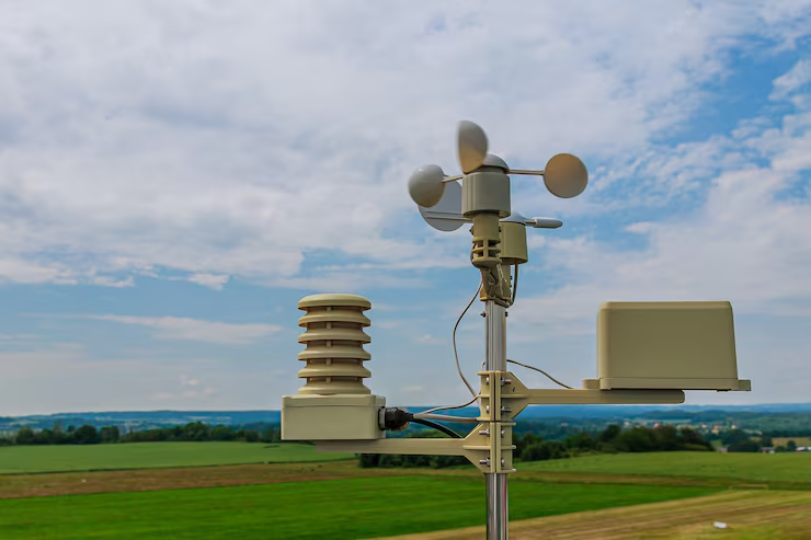
Open Sky View Rakhine
GNSS signals come directly from satellites. If the sky is clear, the signals are strong and accurate. If buildings, trees (making trees), or mountains block the signals, the results become weak or unreliable. Therefore, it is always better to keep the equipment in an open sky(making trees), or sky trees,-sky area. This simple step is a very powerful tool for any surveyor, improving data reliability and accuracy.
Looking at the open sky should be a daily habit for professional surveyors. When the satellite has maximum visibility, the data is more accurate and error-free. Tools like Leica An open sky view is important not only for accuracy but also for signal consistency. Every minute of data counts in survey projects. If the signal is weak, post-processing requires additional time and effort. Professionals always check satellite visibility and obstruction when choosing a survey site.
Avoid multipath errors
Multipath error is a common problem with GNSS projects. This happens when the signal is reflected from a hard surface and reaches the receiver. The reflected signal confuses the original signal, resulting in erroneous data. This problem is more acute when surveying near metal or water. To avoid this problem, always use your device in a glare-free location.
Satellite Nakshatra Check
- GNSS accuracy depends on satellite availability.
- Best results are obtained if more satellites are visible at a time.
- Every professional should check the satellite status of their receiver.
- Always select a survey time when maximum satellites ar Scanner Open Sky View the maximum number of available.
- This makes the results of small planning projects highly accurate.
Use of dual frequency
Single-frequency receivers handle only one signal and are rarely reliable. Dual frequency makes frequency receivers process multiple signals and remove ionospheric errors. These tools are a bit expensive but are a great investment for any professional. Leica GS18 GNSS RTK Rower A r-frequency Rover: A reliable product that guarantees accuracy.
Keep the baseline length short: Rover, short
Asar of baseline length
In study ventures, the length of the pattern has a coordinate effect—a short effect on the exactness and unwavering quality of the information. The shorter the standard, the more exact and precise the estimation. In long pattern-effect ventures, indeed minor blunders can lead to major disparities. P-patterned disparities. Professionals always do their basic planning by understanding the scope of their project. Choosing an appropriate baseline ensures reliable and error-free results for each measurement.

Errors and long baseline
The base line becomes unnecessarily long, measurement errors are introduced. These mistakes make the last come as disparities. outcome of the venture untrustworthy and moderate down the overview prepared. outcome prepared. With a long pattern, the adjustments ended up more complex. complex, and the post-processing time is much longer. T complex, longer. Therefore, every surveyor should avoid long baselines and use the desired length.
Select Optimized Baseline
Professionals always choose a short, optimized baseline that suits project demands and local conditions. An improved baseline yields accurate results and streamlines workflow. Every surveyor should adopt these simple tips to minimize errors and ensure timely project completion such as too longer. Scanner provides more reliable results with a better baseline.
Select the Static and RTK method
There are two main methods used in the survey. The static method is slow, but the results are highly accurate. The RTK strategy is quick and gives real-time rectifications, making it ideal for little ventures. Proficient surveyors ought to continuously select the right strategy based on the needs of their project.
Choose the correct coordinate system.
Each region has its own coordinate system and datum. If invalid data is selected, the entire survey data is transferred. This error is dangerous for the project. Always verify the local coordinate system and set the receiver accordingly. This is a simple step that ensures reliable results.
Set up the correct antenna
Antenna setup is critical to GNSS accuracy. Inaccurate tallness or erroneous leveling of the radio wire may result in erroneous outcomes. Receiving wire tallness and position ought to be carefully checked at the beginning of each venture. Faro and Leica recipients offer helpful radio wire setup choices that streamline the surveyor’s work.
Consider the climate conditions
Weather has a coordinate effect on GNSS execution. Overwhelming clouds and storms debilitate signals. If conceivable, continuously study in a clear climate. If speedy work is required, be beyond any doubt to double-check what comes about. Experts continuously check the climate estimate some time recently, beginning a survey.
Calibration clamor level
It is exceptionally critical to calibrate overview hardware. Dishonorable calibration can lead to blunders in the information. It is a proficient necessity to perform calibrations at the start and conclusion of each extent. Faro and Leica branded disobedient backs require simple calibration. This step guarantees error-free projects.
Utilize post-processing software
A post-processing program refines the crude GNSS information. This program channels out mistakes and makes the last outcome more exact. The Faro Center Premium Laser Scanner provides exact results with outcome more resultsmore results with post-processing. This step is basic for proficient surveyors.
Conclusion
Autosteer frameworks are supportive in cutting-edge studying and cultivating ventures. These frameworks make directing and routing precise. FJD AH2 Water-powered Autosteer Unit to test the FJDresults with the FJD AS2 Direct Prepared Autosteer System. Perfect for experts. These instruments save time and move forward each project.
A last note
GNSS precision is basic to any extended study. Utilizing dependable, branded hardware guarantees quick and dependable results. DJB Machine Parts:Parts:But you get world-class items from companies like Faro, Leica, and FJD. With these devices, you can move forward both efficiency and growth.
FAQ
Q1: What is the best condition for a GNSS survey?
Open skies and a clear climate are idealized conditions for GNSS diagrams. If the sky is clear and there are no buildings or trees adjoining, fanatic signals reach the beneficiary successfully. This makes the data correct and reliable. Experts check sky conditions in each extent to maintain a strategic distance from estimation blunders. This straightforward step takes overview exactness to the following level, and each venture is completed rapidly and easily.
Q2: How to maintain a strategic distance from multipath error.
Multipath mistake is a common issue in GNSS overviews. It happens when the body flag is reflected from a surface and comes to the recipient. The reflected flag confounds the unique flag, causing wrong estimations. Avoid this problem, keep the equipment away from reflective surfaces and metal objects. Faro Focus Premium Laser Scanner Such high-quality tools minimize multipath effects and provide accurate data.
Q3: What is the difference between RTK and static methods?
There are two main methods used in GNSS surveying. The static method takes more time, but the data is highly accurate. Leica GS18 GNSS RTK Rovert is a very reliable option for RTK projects and guarantees real-time accuracy.
Q4: Why are branded GNSS instruments necessary?
Branded tools are a great investment for professional projects. such as the FJD AH2 Hydraulic Autosteer Kit to sleep The FJD AS2 Steer Ready Autosteer System provides reliable and long-term accurate results. Branded equipment is tested and certified, giving every professional confidence. These tools provide the best solutions for modern surveying and farming projects, making projects time- and cost-efficient.
Q5: What is the role of calibration and post-processing?
Proper calibration and post-processing improve GNSS data and remove errors. Calibration is essential at the beginning and end of every project. Faro and Leica tools support easy calibration. Post-processing software filters the raw data and ensures accurate and reliable final results. DJB Machine Parts The tools taken from are post-processing friendly and save time for every surveyor. These steps are the core of GNSS accuracy recommendations for survey projects and should be adopted by every professional.