
Blog
Leading Geospatial Equipment Suppliers Worldwide
Sep
Geospatial tools have become the foundation of modern projects. Without these tools, civil and mining work is slow and fragile. When a professional surveyor has smart geospatial tools, they create a complete record of the site. These tools accurately display the shape, slope, and lines of the land. Every project’s success begins with a smart survey, and these tools make surveying fast and safe. If a team conducts manual surveys, risk is eliminated and time is wasted. In today’s global era, the demand is clear: professional survey tools are a must-have. Leading suppliers operating worldwide play a key role in every project. For the best and most trusted geospatial tools DJB Machine Parts A smart source from which pro teams gain exact tools.
Why Suppliers Matter?
The role of the suppliers is not only to sell the tools but also to guide, counsel and assist the professional teams during the entire project lifecycle. A surveyor has to have good tools when beginning a project but the supplier must also be reliable and trusted to provide a stable quality and reliable service. In case the supplier is weak, slow, and indifferent, it is likely that the whole project will soon be in danger, the time limits can be easily violated, and the trust of clients can be easily broken.
Powerful suppliers do not just sell to pro teams, they also give updates useful to them, introduce them to current technology, and assist them in adjusting to the changes in the industry. This continuous process streamlines projects to be efficient and more secure throughout the project cycle. The reliability of a supplier also ensures good after-sales services, which is a great benefit to professional surveyors who are used to performing at their best. This reliability and dedication are what ultimately make a brand and its supplier stand out and become recognized as leaders on a global scale.

Smart Grading Tools for Earthworks
Smart grading tools have proven to be a critical and effective component of earthworks projects in the present times due to the fact that they contribute to the delivery of accuracy, efficiency, and long-term savings. These high-tech tools are aimed at the recognition of slopes, measurement of levels, and the flattening of the land, which must be carried out in the most accurate way possible to make sure that each phase of the project is taken correctly.
In case the site is not flat or smooth, the grading tools are used to level the surface and this will save precious fuel, minimize unnecessary manhours and save time in rectifying the site again. In such a manner, resources are optimized, and this contractors and surveyors can cut the costs twofold and make the design base more powerful and long-lasting.
The other significant benefit is that it ensures consistency of the results hence reduced number of errors and client satisfaction. Due to these advantages, smart grading devices are quickly becoming very popular in most parts of the global world, and an increasing number of professional surveyors are using them as their initial option to attaining quality output and staying competitive in the business. For the best information, visit Smart Grading Tools for Earthworks Projects Where details and a clear guide of use are available.

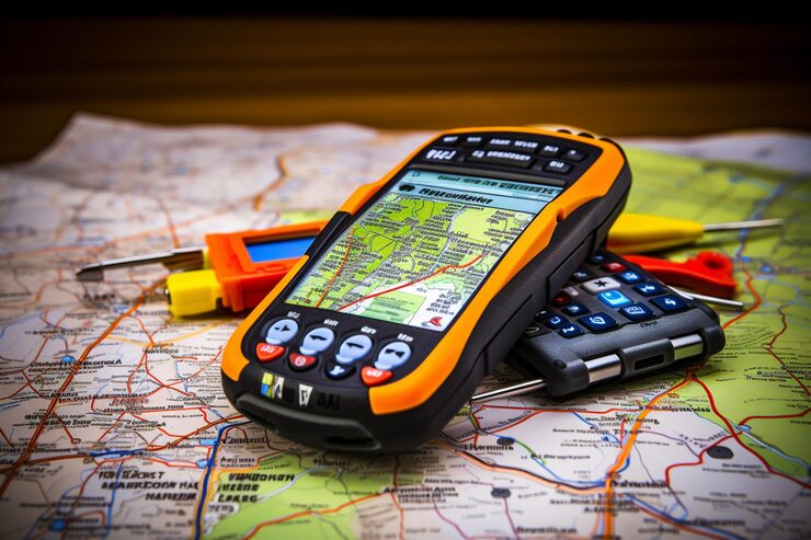
Types of Geospatial Tools
There are many types of geospatial tools, each with a clear role. Demand for these tools varies according to the field and project needs. Here’s a list of some of the smart types used by project teams.
- GPS tools that record real-time data of the site and make the survey accurate
- Laser scan tools that create 3D data and provide a full image of the site
- Grading tools that detect slope and level and smooth the land
- Control tools that guide heavy machines and make work faster
Role of Machine Control Suppliers
Machine control tools have become an essential and indispensable element of any large-scale construction project since they introduce precision, safety, and efficiency to the construction site. With the help of the professional team, which applies the new machine control systems, their work is not only faster but also safer as tools assist in minimizing the number of manual errors and enhance the accuracy of actions. These systems ensure that heavy machinery operates on a guided intelligent track to avoid unnecessary rework and to optimize the utilization of the resources and to save precious fuel and energy.

In the absence of effective control tools, project expenses will soon increase, schedules will be disrupted, and the general efficiency will be impaired. Conversely, the global suppliers offer the professional surveyor and contractors the most current machine control technologies, which make them remain competitive and up to date with industry standards.
The high level of support and after-sales provided by these suppliers assists the pro teams to gain maximum profit, reduce the downtime and build trust with the long-term clients. The integration of the best tools as well as reliable suppliers has emerged as a major success factor in large-scale construction projects in the modern construction industry. Visit for details Machine Control Suppliers for Global Projects.
FJD AS2 Autosteer System
The FJD AS2 Steer Ready Autosteer System is a smart and modern choice. This system allows tractors and dozers to move along a precise line. Pro teams consider this system the best option for fast and fuel-efficient operation. When the machine follows a line, work becomes smoother and client trust is enhanced. This tool is in worldwide demand because it plays a strong role in both agriculture and mining. For full details on this product, visit FJD AS2 Steer Ready Autosteer System.
Civil Engineering with GPS Solutions
GPS solutions have become a necessity in civil engineering projects. Roads, bridges, and smart sites are not built accurately without GPS surveys. GPS tools record every slope and level of data and provide maps to project surveyors. When the design is clear, the project is safe and client trust is strong. Civil teams complete every stage quickly and safely with the help of GPS tools. This trend is driven by worldwide demand and the need for rapid project completion. Visit Civil Engineering with Advanced GPS Solutions Where full details and a guide for use are given.
Gains of Geospatial Tools
The benefits of geospatial tools are clear and strong for every pro team. Understanding these benefits is important for every buyer.
- These tools make surveys faster and save time, which makes the project smooth and client-friendly.
- These tools save fuel and costs, which increases company profits and reduces risk.
- These tools make the design accurate and provide real-time data of the site, which is error-free.
- These tools increase worker safety and reduce manual risk, which is a strong factor.
DJB Machine Parts as a Trusted Source
DJB Machine Parts is a globally trusted supplier of professional survey and control tools. The site offers every modern tool needed for mining, civil, and agricultural projects. Smart tools like laser scanners, autosteer kits, and GPS systems are all listed in one place. The DJB Machine Parts site is easy and user-friendly, with clear product details. Professional teams that acquire tools from DJB experience safe and cost-effective projects. Visit for trusted tools DJB Machine Parts.
Conclusion
Geospatial tools have become an essential part of modern world projects. These tools provide accurate site data and make designs safe. Pro suppliers who work worldwide provide the latest tools and support to teams. Smart grading tools, GPS systems, machine controls and autosteer kits are essential items for a project. Having a trusted supplier is a strong factor for every pro surveyor. DJB Machine Parts is a worldwide trusted source that provides smart and modern geospatial tools. If you are a pro surveyor, DJB’s tools will make your project safe, fast and cost-effective.
FAQs
Q1. What is the main role of geospatial tools?
These tools record site data and make surveys smooth.
Q2. Why are smart grading tools used in earthworks?
These tools detect slopes and levels and make the land smooth.
Q3. What is the main advantage of the FJD AS2 autosteer system?
This system runs the machine online and saves fuel.
Q4. Why are GPS tools needed in civil engineering?
GPS tools record data and make the design secure.
Q5. Who is the best geospatial tools supplier?
DJB Machine Parts is a trusted supplier that provides tools worldwide.