Blog
Topographic Survey Tools for Professionals
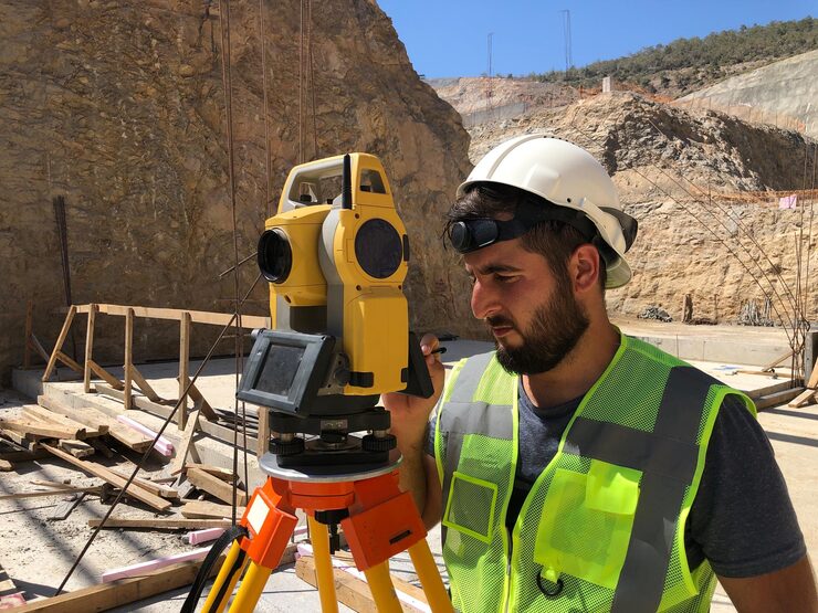
Surveying is the foundation that gives every civil and mining project a clear and safe direction. Unless the survey data is accurate and intelligent, the design is incomplete. Topographic survey tools are at the heart of this process, providing a complete record of each site. These tools preserve the land’s shape, slope, and height in detail, supporting the project team at every step.
When a surveyor has smart tools, they complete the project quickly and safely. These tools are not only for map creation but also reduce project time, cost, and safety. In today’s modern era, these tools are in global demand, and project teams cannot function without them. Trusted sources for the best survey and control tools DJB Machine Parts It’s a smart choice to visit where every pro gets the tools they need.
Why Topographic Survey Tools are Vital
Topographic survey tools play an essential role from the beginning to the end of a project. When a project is planned, a detailed survey of the site is essential first. If the survey data is not accurate, every step becomes risky and the client’s trust is weakened. These tools create 3D data and clear images of the site, which makes the design accurate. These tools are used in both hilly sites and flat land, and every small point is recorded. When the pro team uses survey tools, their work is fast and they have a safe base. Manual survey often creates errors, which increase cost and time. With the help of tools, these errors are avoided and the output is strong. For a pro surveyor, tools act like a shield that protects them at every stage.
Smart Grading Tools for Survey
Smart grading tools have become a game changer for earthworks and mining. These tools accurately detect the slope and level of the land and provide the pro teams with all the data that is best for the design. If the site is rough or the ground is uneven, then grading tools help them in getting it to the exact level. This process saves both fuel and time and results in faster work output. In the event that the project is accomplished on time and at a minimal cost, the trust of the client will be enhanced. Pro teams consider grading tools a must-have choice because they make their work smooth. Smart grading tools are becoming a trend in every civil and mining project and their demand is increasing globally. For details and tools information, visit Smart Grading Tools for Earthworks Projects.

Common Survey Tool Types
There are many types of survey tools, each with its own role and value. The range of tools is wide, and survey teams choose the ones that best suit their needs. Here’s a detailed list of some smart and widely used types.
- GPS survey tools that create fast and accurate land maps and record site data for each site, which is ideal for design.
- Laser scan tools that do 3D scans of the site and make a record in detailed form, which is smart for a professional survey
- Grading tools that detect slope and level and balance land are a must-have step in earthworks and mining projects
- Control tools that smartly guide heavy machines and keep them moving along a single line, saving both fuel and time
Role of Machine Control Tools
Control tools used in machines are utilized as a backbone in the civil as well as the mining sector. Surveying is essential in heavy machinery activities, and manual movements are time-consuming. Machines move along a defined path when machine control tools are installed, therefore guaranteeing accurate work. These tools save fuel and expenditure in pro teams. Without a direct guide to the machines, the work will be slow and the design will be cumbersome. These problems are prevented by control tools and allow the straight direction of pro surveyors. These cutters are machine and operator friendly and therefore safe. Every pro surveyor needs to have machine control tools. Show up to the finest machine control supplier, Machine Control Suppliers for Global Projects.
FJD AS2 Steer Ready System
The FJD AS2 Steer Ready Autosteer System is a smart and modern tool designed for heavy tractors and dozers. This system steers the machine on a precise line, reducing fuel waste. Professional surveyors use this tool because it’s easy to fit and delivers fast results. The system’s role in both farming and mining is clear. When the machine moves on a straight, smart path, work is faster and safer. This tool is a strong advantage for pro teams, giving them both client trust and project success. For details on this product, visit FJD AS2 Steer Ready Autosteer System And make smart choices for your project.
Civil Engineering with GPS Tools
The demand for GPS tools in civil engineering projects is increasing day by day. The design of roads, bridges, and smart sites is impossible without GPS surveys. These tools create real-time site data and provide project teams with every detail. When planning a road, every slope and level must be recorded. GPS tools record all this, ensuring a safe and accurate project.

Professional surveyors use GPS tools to create a map that provides a clear basis for design and construction. GPS tools play an essential role in every civil project, and their demand is high in every country. Visit Civil Engineering with Advanced GPS Solutions And make a trusted choice for your project.
Key Gains of Survey Tools
The benefits of topographic survey tools are clear and visible, supporting project teams every step of the way. Using these tools gives every project a smart and secure foundation.
- These tools save time and make every project fast and smooth, which is best for both the client and the team.
- These tools save fuel and reduce costs, which increases company profits and makes every stage low-cost.
- These tools improve worker safety and reduce manual risk, which is a smart gain and protects the pro team.
- These tools clarify designs and provide a strong foundation for projects, which increases client trust and value.
Why DJB Machine Parts is Trusted
DJB Machine Parts is a globally trusted source for professional survey and control tools. The site offers every type of tool ideal for civil mining and agriculture projects. From the Faro Focus Laser Scanner to the FJD Autosteer and Leica GNSS Rover, all smart tools are available in one place. The DJB Machine Parts site is user-friendly, with clear product details. This is a one-stop shop for professional surveyors, providing every needed tool. If you need smart tools for your project, visit DJB Machine Parts And select trusted tools.

Conclusion
Topographic survey tools are a strong and smart partner for a pro surveyor. These tools create real-time site data, making every stage of the project smooth. Smart grading tools, GPS systems, machine control, and autosteer kits allow a pro team to work fast and safely. Tools like the Faro laser scanner and Leica GNSS Rover have become essential parts for survey teams. If you are a pro surveyor, it is always best to source tools for your project from a trusted supplier. DJB Machine Parts is a global source that provides survey and control tools, building strong client trust. Pro survey teams that use DJB Machine Parts have safe, fast, and cost-effective projects.
FAQs
Q1. What is the role of topographic survey tools?
These tools record site data and create maps.
Q2. Why are smart grading tools used in surveys?
These tools detect slope and level and make the design clear.
Q3. How is the FJD AS2 system for pro survey teams?
This system runs the machine online and saves fuel.
Q4. Why are GPS tools needed in civil projects?
GPS tools create real-time data and secure designs.
Q5. Who is the best survey tools supplier?
DJB Machine Parts is a trusted source that provides global tools.

