
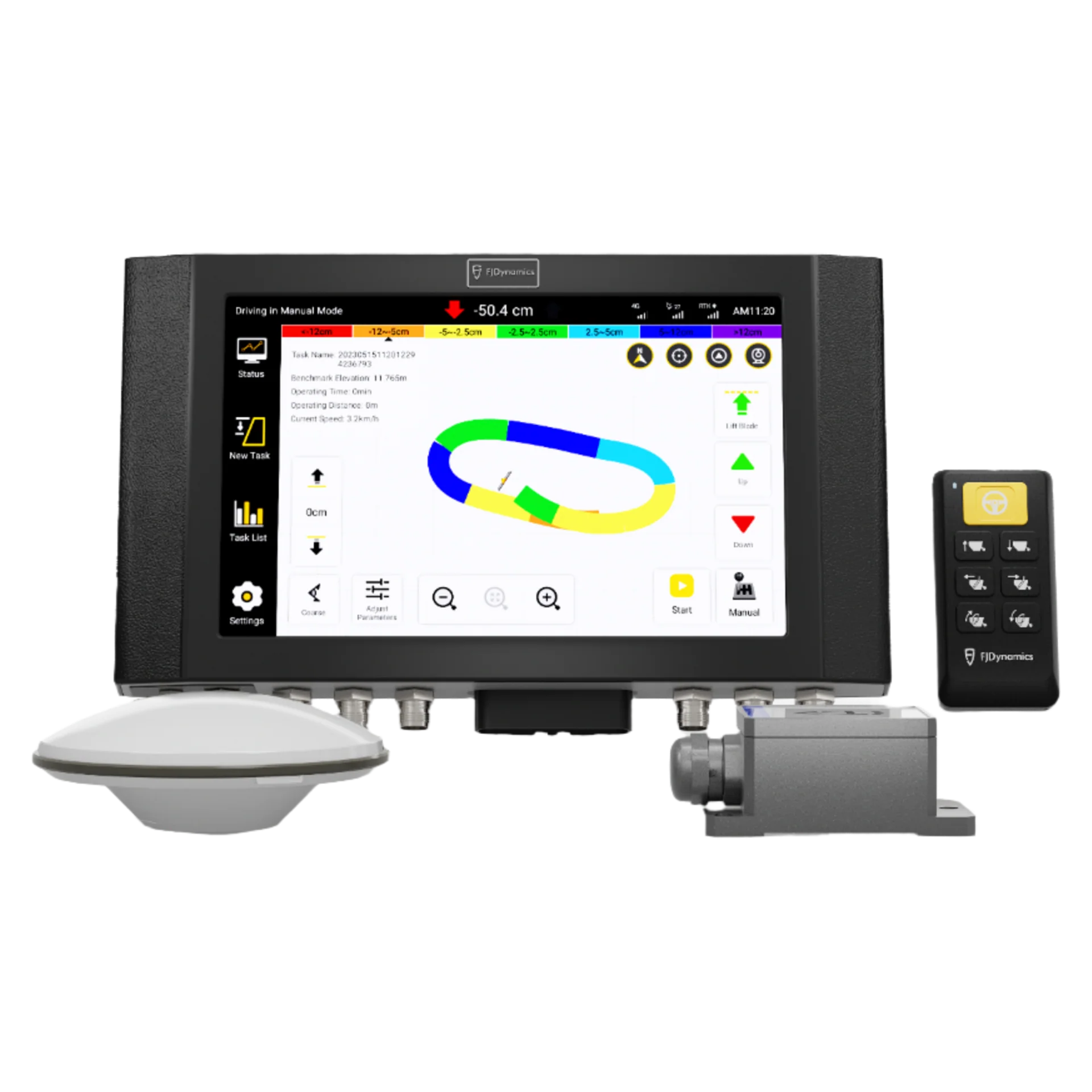
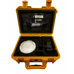
FJD AL01 3D Ground Leveling System


Original price was: £5,800.00.£5,000.00Current price is: £5,000.00.
FJD AL01 3D Ground Levelling System – Precision Agriculture Redefined
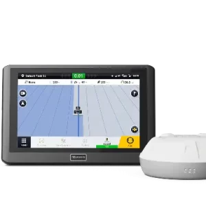
Elevate your farmland productivity with the FJD AL01 3D Ground Levelling System, a cutting-edge solution designed for precision levelling, terrain planning, and optimal water management. Powered by advanced GNSS and RTK high-precision positioning technology, this system delivers unmatched accuracy of 2.5 cm, transforming uneven fields into smooth, uniform terrain for enhanced crop yields and resource efficiency.
FJD AL01 3D Ground Levelling System – Precision Agriculture Redefined
Elevate your farmland productivity with the FJD AL01 3D Ground Levelling System, a cutting-edge solution designed for precision leveling, terrain planning, and optimal water management. Powered by advanced GNSS and RTK high-precision positioning technology, this system delivers unmatched accuracy of 2.5 cm, transforming uneven fields into smooth, uniform terrain for enhanced crop yields and resource efficiency.
Why Choose the FJD AL01 3D Ground Levelling System?
- High-Precision Levelling: Achieve centimeter-level accuracy with GNSS and RTK technology, ensuring perfectly levelled fields every time.
- Boost Efficiency by 40%: Say goodbye to time-consuming manual setups and limited signal ranges of traditional laser systems. The AL01 covers larger areas faster, saving you time and labor.
- Optimize Water Management: Improve irrigation efficiency and reduce water usage by up to 22% with even terrain and customizable slope designs.
- Versatile Applications: Ideal for reclaiming wasteland, levelling fields, converting slopes into terraces, and preparing rice paddies for planting.
- User-Friendly Design: Digitize your terrain with ease using boundary mapping and internal point collection—no professional training required.
Key Features of the FJD AL01
- Terrain Digitalization: Collect elevation data effortlessly and generate real-time cut/fill maps for precise earthwork planning.
- Switchable Modes: Toggle between Precise Levelling Mode for fine-tuning and Wasteland Reclamation Mode for tackling rough terrain.
- Advanced Analytics: Access fill-and-excavation data and earthwork movement insights to minimize costs and fuel consumption.
- Slope & Water Flow Design: Customize terrain angles and water direction to enhance drainage and soil quality.
- Task History Access: Automatically save completed tasks to your list for easy reference and to avoid rework.
Real-World Success with the FJD AL01
- Jordi, Spain: Optimized sunflower planting with smoother fields, improving water distribution and crop management.
- Thailand Farmer: Enhanced rice paddy preparation, boosting water efficiency and yields with minimal effort.
Benefits for Precision Agriculture
The FJD AL01 3D Ground Levelling System takes precision agriculture to the next level. By replacing outdated laser systems, it eliminates setup hassles, weather limitations, and signal constraints. With a 40% increase in efficiency and a larger operational range, this GNSS-based solution empowers farmers to:
- Increase crop productivity with uniform terrain.
- Save resources like water, fuel, and labor.
- Reclaim and revitalize unused land with ease.
Technical Specifications
- Accuracy: ±2.5 cm
- Technology: GNSS & RTK Positioning
- Max Speed (Light Load Mode): 15 km/h
- Fuel Savings: Up to 10% less consumption in Light Load Mode
- Coverage: Outperforms laser systems in range and reliability
Upgrade Your Farming Today
Ready to transform your fields and maximize your yields? The FJD AL01 3D Ground Levelling System is your key to smarter, more sustainable farming. Whether you’re levelling dry land, designing slopes, or preparing rice paddies, this system delivers precision, efficiency, and results.
Contact us now to learn more or request a demo of the FJD AL01 and experience the future of farmland levelling!
Be the first to review “FJD AL01 3D Ground Leveling System”
Related products


Reviews
There are no reviews yet.